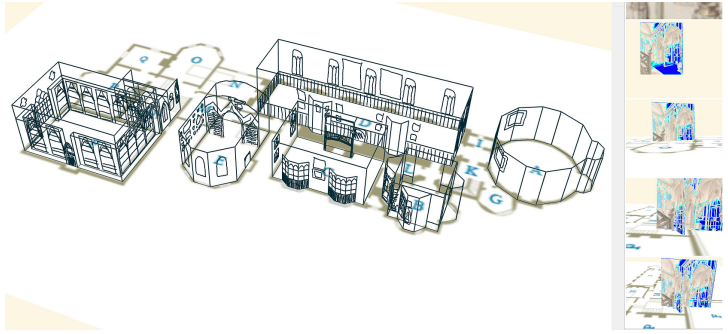
We present a work-in-progress report on a sketch- and image-based software called “CHER-ish” designed to help make sense of the cultural heritage data associated with sites within 3D space. The software is based on the previous work done in the domain of 3D sketching for conceptual architectural design, i.e., the system which allows user to visualize urban structures by a set of strokes located in virtual planes in 3D space. In order to interpret and infer the structure of a given cultural heritage site, we use a mix of data such as site photographs and floor plans, and then we allow user to manually locate the available photographs and their corresponding camera positions within 3D space. With the photographs’ camera positions placed in 3D, the user defines a scene’s 3D structure by the means of stokes and other simple 2D geometric entities. We introduce the main system components: virtual planes (canvases), 2D entities (strokes, line segments, photos, polygons) and provide a description of the methods that allow the user to interact with them within the system to create a scene representation. Finally, we demonstrate the usage of the system on two different data sets: a collection of photographs and drawings from Dura-Europos, and drawings and plans from Horace Walpole’s Strawberry Hill villa.
Authors: V. Rudakova, N. Lin, N. Trayan, T. M. Sezgin, J. Dorsey and H.
Rushmeier